I love vintage maps, the fanciful decorations, the creative spelling, the even more creative coastlines! Still, it’s impressive what navigators and mapmakers were able to do with a cross staff, an astrolabe, and bits of string. (Did you know how to calculate latitude wasn’t discovered until the eighteenth century?)
With the release of the second book in the Pirates of Port Royal series, The Penitent Pirate, I decided to create maps of my own based on vintage maps. It was a fascinating labour of love! I made one of the seas around Port Royal and Tortuga, where much of the action of the series takes place, and I did another of the old city of Port Royal. In both maps I marked places of interest in my stories.
Port Royal was destroyed by an earthquake in 1692, and no contemporary map exists. I based my map on an eighteenth century map and used archaeological studies, including the very impressive work of Michael Pawson and David Buisseret to fill in the gaps.
Both maps are included in The Penitent Pirate, but for anyone who wants to be able to zoom in for a better look, I’ve also posted them here. I hope you enjoy poring over them as much as I loved making them!
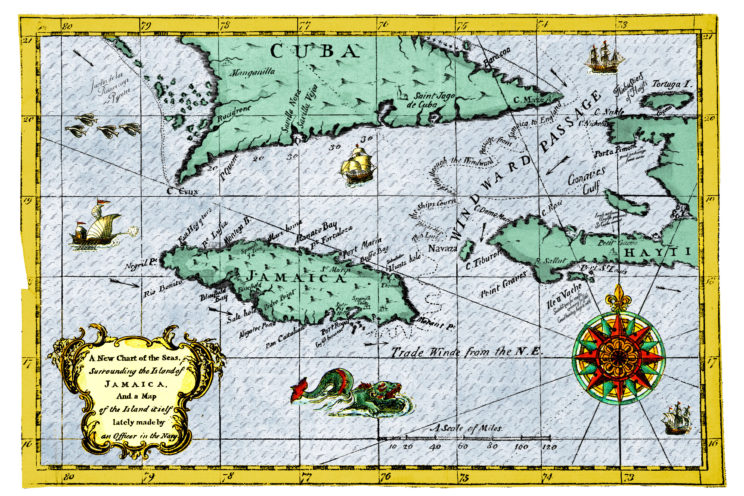
A chart of the seas around the island of Jamaica, showing places of interest, currents, and sailing routes

A map of Port Royal on the island of Jamaica, showing the layout of the streets, places of note, and unpatented lots.